- About
- Affiliates
- Join
- Publications
- Estuaries and Coasts
- CERF's Up! Quarterly Bulletin
- Coastal & Estuarine Science News (CESN)
- CERF-Lit
- Advertising
- Programs & Events
- Inclusive Culture
- Communities
Coastal & Estuarine Science News (CESN)Coastal and Estuarine Science News (CESN) is an electronic publication providing brief summaries of select articles from the journal Estuaries and Coasts that emphasize management applications of scientific findings. It is a free electronic newsletter delivered to subscribers on a bi-monthly basis. You can have future issues delivered to your email inbox on a quarterly basis. Sign up today! 2023 Issue 4Table of ContentsMovin' on Up Assessing mangrove expansion in the U.S. 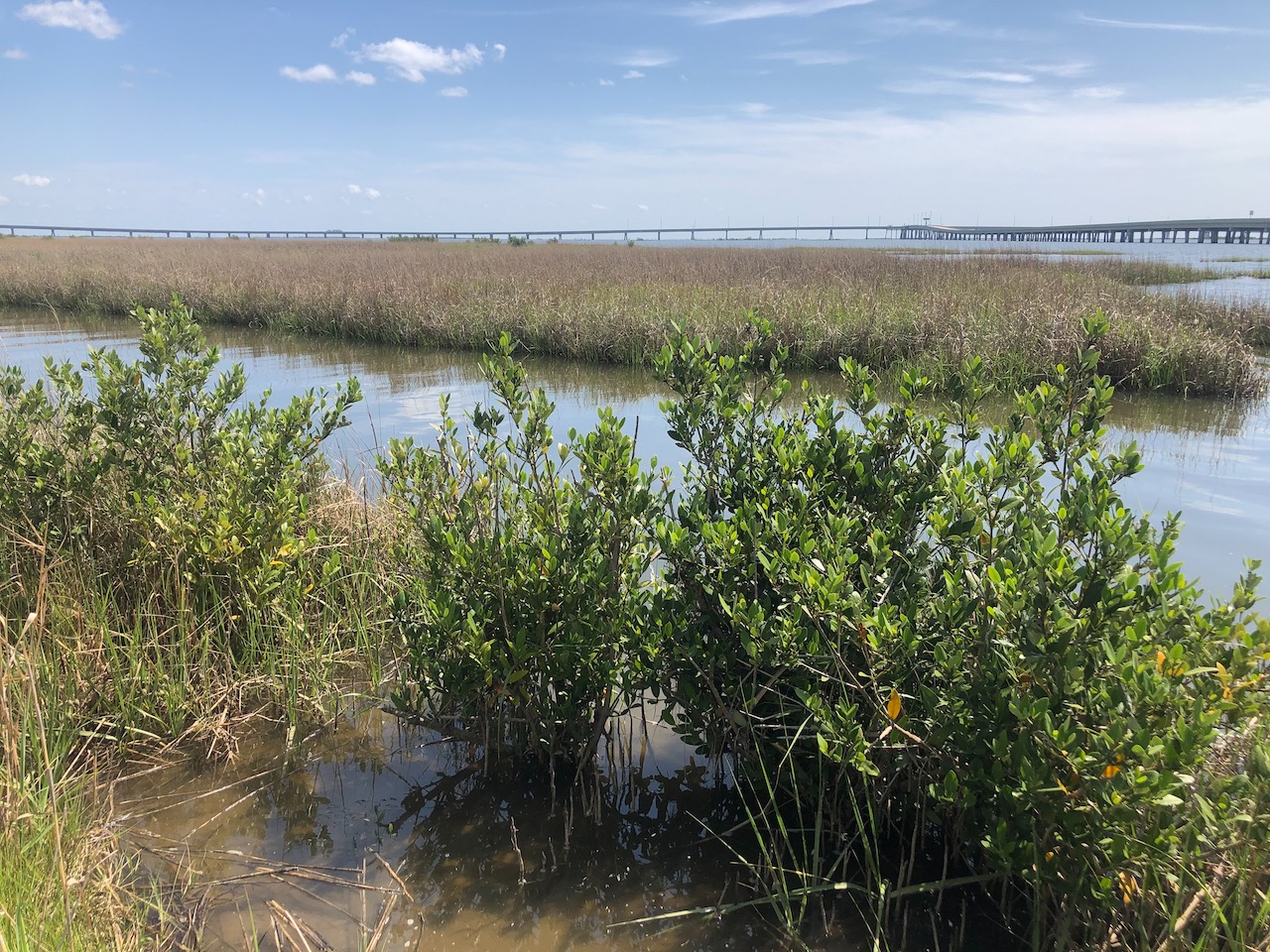
Climate change is altering ecosystems and shifting range limits for many species. With warming winter temperatures, mangrove forests are encroaching on saltmarshes in temperate and subtropical areas. This transition zone can be quite dynamic due to its abundance of suitable coastal wetland habitat and the balance between warmer temperatures, which favor expansion, and exposure to freezing conditions, which can cause mortality. Recently, 52 coastal scientists convened to assess the distribution of mangroves at their rapidly changing range limits along the Gulf and Atlantic coasts of the U.S. Expert elicitation was also used to identify recurring themes related to data limitations and knowledge gaps. Mangroves at their northern range limits occur as either large expanses of short, dense mangroves or simply a mangrove-marsh mosaic with lower densities. They are often shorter, wider, multi-stemmed, and more shrub-like than their tropical counterparts, which do not experience freezing conditions and grow as tall forests. In fact, temperature extremes at the poleward limit in North America are far colder than comparable range limits on other continents. The group pointed out the need for customized methods and focused studies to fully understand mangrove dynamics and the mechanisms of northward dispersal and expansion. The northern edge of mangroves is hard to capture with available mapping products, and the group identified many locations where mangrove presence and density was over- or underestimated when compared to expert knowledge. Although some limitations can be addressed through regional data-sharing, there is insufficient data to fully track expansion, and the group called for improved spatial and temporal data regarding changes in mangrove structure and abundance. Understanding rapidly changing range limits is critical for foundation plant species everywhere as we work to anticipate and prepare for the cascading effects of climate-induced species redistribution on ecosystems and their services. Source: Bardou, R. et al. 2023. Rapidly Changing Range Limits in a Warming World: Critical Data Limitations and Knowledge Gaps for Advancing Understanding of Mangrove Range Dynamics in the Southeastern USA. Estuaries and Coasts. DOI: 10.1007/s12237-023-01209-7 Image: Mangroves encroaching into saltmarshes in Grand Isle, Louisiana / Rémi Bardou Mapping Hypoxic Responses to Nitrogen Loading Molybdenum in sediments can be a useful indicator 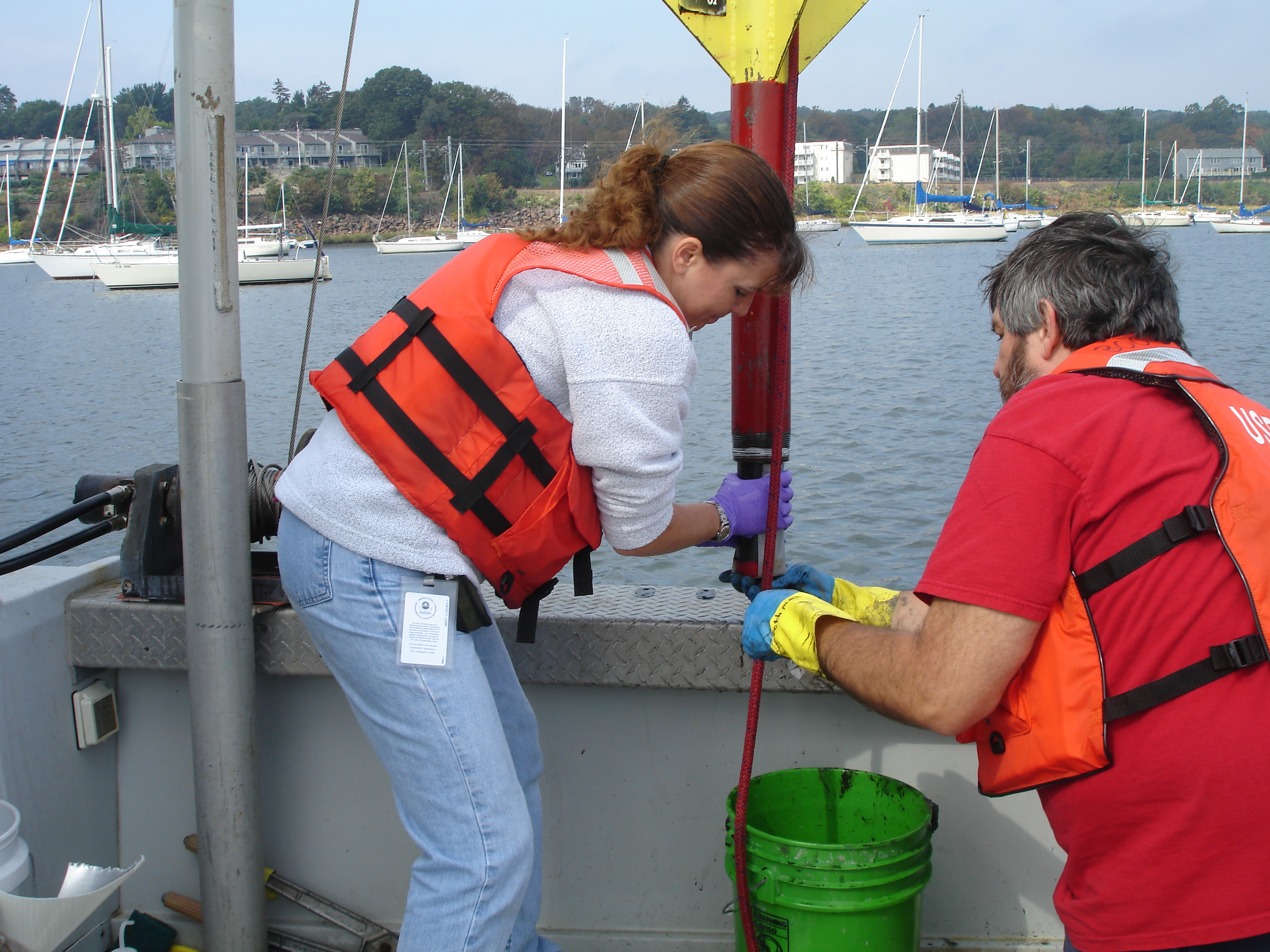
Hypoxia as the result of excess nutrient input is becoming increasingly common in smaller coastal estuaries—doubling every decade since the 1960s. However, many factors besides nutrients can affect dissolved oxygen concentrations, including water circulation patterns, rainfall, and wind. As a result of this multiplicity of factors, hypoxia varies over time and space and can be hard to relate back to nutrient loading. Molybdenum (Mo) in surface sediments has recently been linked to hypoxia in the overlying water column. If Mo concentrations are shown to vary with nitrogen loading, then measuring Mo may be useful for developing N-loading standards that will minimize hypoxia. A team of EPA researchers calculated N loads for seven embayments within Rhode Island’s Narragansett Bay using a land use-based model that considered atmospheric deposition, fertilizers, and wastewater sources of N. Inputs were normalized based on the volume of the receiving water and the local residence time to develop spatially explicit estimates within each embayment. Mo was measured in surface sediments from sampling sites selected within and across the embayments to span the range of N loads. The team did find the highest Mo concentrations in places with the highest N loading. However, locally high Mo concentrations were also associated with boat basins, suggesting that boats are a possible unaccounted-for source of either N or Mo. Using these results (except for those from boat basins), the team showed that a threshold for N loading could be set based on the Mo data. If sediment Mo is shown to be a reliable quantitative indicator for the mean annual duration of hypoxia, this would be a promising approach for evaluating spatial patterns of hypoxia extent. It also provides an integrated measurement of conditions over several years that can be used when direct measurements of dissolved oxygen are unavailable. Source: Boothman, W.S. & L. Coiro. 2023. Mapping Hypoxia Response to Estuarine Nitrogen Loading Using Molybdenum in Sediments. Estuaries and Coasts. DOI: 10.1007/s12237-023-01215-9 Image: The authors collecting a short sediment core in Greenwich Bay / Barbara Bergen Catamarans Can Contract Coastal Wetlands 60 years of change on the Portuguese west coast 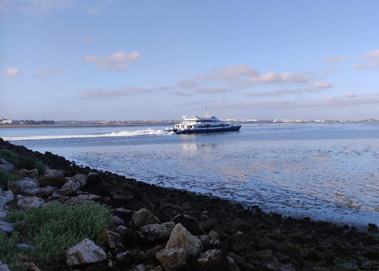
Vessel traffic has been increasing in many coastal areas, with much of it now involving faster vessels that generate larger wakes. The Tagus Estuary, one of Europe’s largest, has been the gateway to Lisbon for centuries, and in 1995, fast catamarans began replacing smaller, slower cacilheiros as public vessel transport. To better understand the impacts of vessel traffic on tidal flats and saltmarshes, researchers quantified their rates of contraction and expansion across Moita-Montijo Bay on Portugual’s west coast over a 60-year period. The team analyzed landcover and shoreline changes using aerial imagery from 1958, 1977, 1995, and 2018. They also conducted field surveys and collected vessel data from three catamaran and two cacilheiro types. They found that exposed saltmarshes outside of abandoned salt pans have been contracting since 1958. Contraction rates more than doubled in areas bordering vessel transit routes after the modernization from cacilheiros to catamarans, which resulted in stronger wake waves. Tidal flats expanded from 1977 to 1995, but have since contracted along the route of fast transport catamarans (though expansion was still observed in the sector without catamaran navigation). Catamaran-induced waves also caused erosion of oyster reefs along the banks of the channel, which contributed to deposits of coarse sands and bivalve shells along the tidal flat margin beginning in 1995. The team predicts that both tidal flats and exposed saltmarshes will continue to contract, especially along the vessel route. This will result in coastal squeeze, as they will be unable to migrate inland due to the built-up environment. Measures for containing contraction are needed, such as readjusting the transit speed of catamarans inside the bay to reduce wake impacts. Source: Martins, D. et al. 2023. Changes in Vessel Traffic Disrupt Tidal Flats and Saltmarshes in the Tagus Estuary, Portugal. Estuaries and Coasts. DOI: 10.1007/s12237-023-01198-7 Image: Catamaran sailing from Seixalinho harbor / João Duarte Nutrient Declines in the Yangtze River: A Success Story Human actions can lead to demonstrable water quality improvements 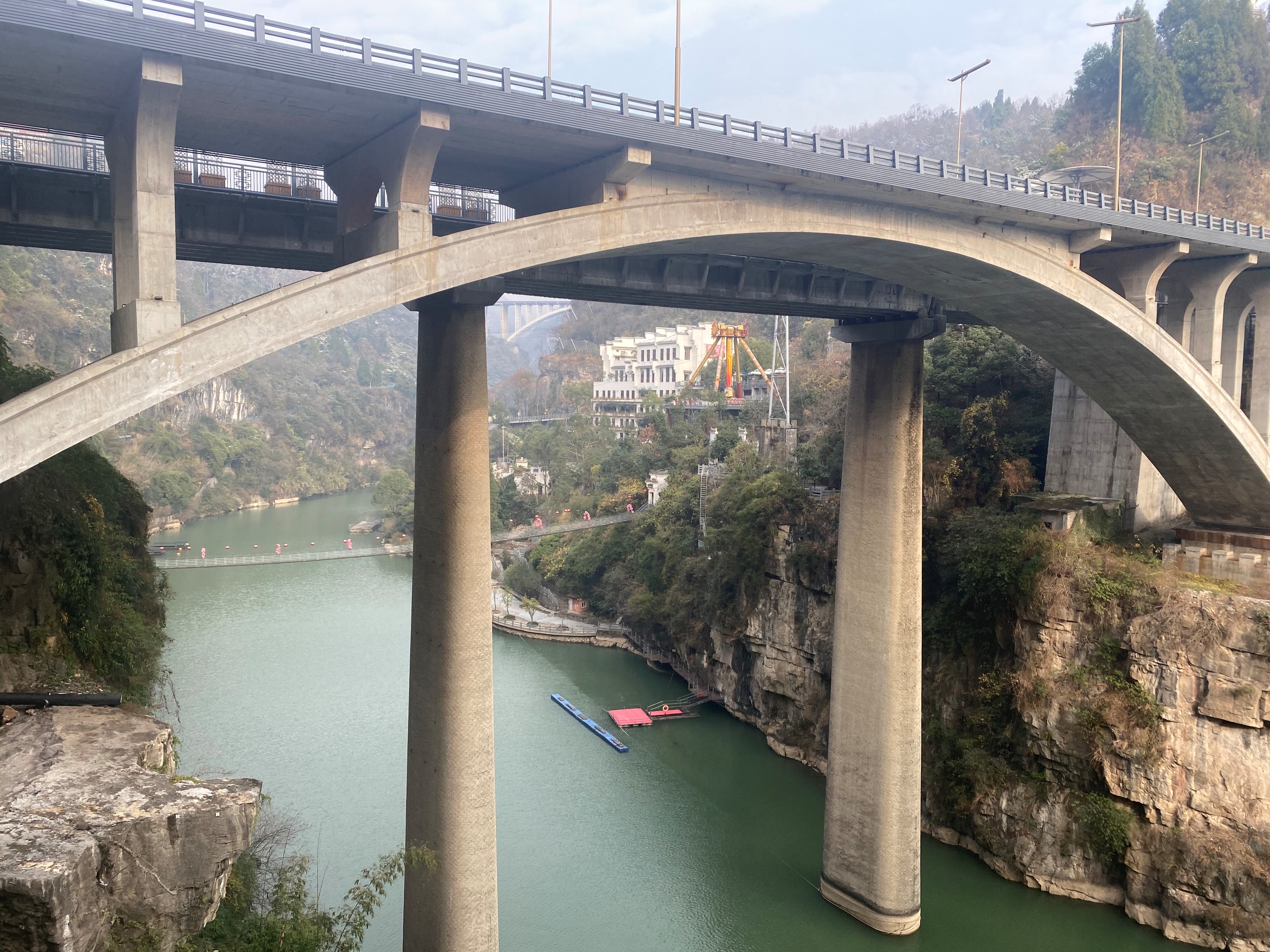
China’s Changjiang (Yangtze) River is one of the largest in the world. It’s been the focus of intensive anthropogenic activities including the construction of 50,000 dams, as well as numerous ecological restoration projects and efforts to improve water quality, such as reductions in fertilizer use in the watershed. Understanding the extent to which human activities and a changing climate are contributing to worsening (or improving) coastal nutrient pollution requires analyzing time-series data over a range of timescales. To examine nutrient patterns and trends in the system, a team from East China Normal University collected surface river water samples monthly in the Lower Changjiang River main channel from November 2016 to August 2020, and daily during an extreme flood event in July 2020. Over both daily and seasonal timescales Changjiang River discharge had a dominant influence on nutrient concentrations: Discharge showed a dilution effect on nitrogen and phosphorus, with their highest and lowest concentrations occurring in dry and flood seasons, respectively. Combining the results of this study with previous data collected at the same site, the team found that N and P concentrations and annual fluxes in the lower Changjiang River declined significantly over the past decade. This was largely due to the control of anthropogenic N and P fertilizer usage within the watershed—reversing a trend of deteriorating aquatic environment that lasted from the 1960s through about 2010. Specifically, the turning point year for NO3− and PO43− was 2012, after which their concentrations decreased at rates of 2.9 and 0.1 μM per year, respectively. That nutrient reductions (both the concentrations and annual fluxes) were observed over the past decade—despite climate change modifying river flow and the frequency of extreme weather events—suggests that management actions can have a demonstrable, positive effect on water quality. Source: Wang, Y. et al. 2023. Recent Declines in Nutrient Concentrations and Fluxes in the Lower Changjiang River. Estuaries and Coasts. DOI: 10.1007/s12237-023-01216-8 Image: Changjiang River at Yichang / Lei Gao |