- About
- Affiliates
- Join
- Publications
- Estuaries and Coasts
- CERF's Up! Quarterly Bulletin
- Coastal & Estuarine Science News (CESN)
- CERF-Lit
- Advertising
- Programs & Events
- Inclusive Culture
- Communities
Coastal & Estuarine Science News (CESN)The mission of Coastal & Estuarine Science News (CESN) is to highlight the latest research in the journal Estuaries and Coasts that is relevant to environmental managers. It is a free electronic newsletter delivered to subscribers on a bi-monthly basis. Sign up today! 2024 Issue 3Table of ContentsFewer People, More Wildlife Least Terns thrived in the Gulf of Mexico during the pandemic.
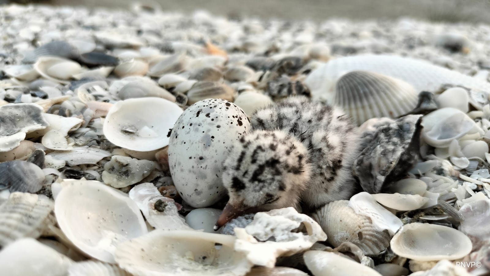
Using historical data as well as field sampling from 2016 to 2021, the team evaluated bird abundance and species richness, as well as nesting success of Least Terns (Sternula antillarum), on a public beach called Playa Norte. They also monitored nests at three other locations on the island with varying levels of human activity that are occasionally used as nesting sites. The researchers did not find differences in species richness during the lockdown. However, they did find that diminished pedestrian traffic from mid-June 2020 to May 2021 increased bird abundance at Playa Norte and also reduced the rate of tern nesting failure by approximately 12% to 28%. At the other beaches, the reduced presence of people allowed the terns to select and occupy new nesting sites never used before in these areas. However, far fewer birds nested in these other three beaches—which serves as a reminder that physical conditions favorable for shorebird nesting are a prerequisite for success independent of human pressures. Although the Least Tern is not a species of concern globally, its populations are declining as human activities disturb the coastal dunes near or in their breeding areas. To enhance reproductive habitat quality and wildlife conservation in coastal habitats, policies should prioritize reducing beach pedestrian traffic—especially during nesting season. And while species diversity may not change, individual species may benefit. Source: Canales‑Delgadillo, J.C. et al. 2024. Assessing Southern Gulf of Mexico Resilience: Least Tern Nesting Failure During the COVID‑19 Pandemic. Estuaries and Coasts. DOI: 10.1007/s12237-024-01341-y Image: Least Tern nesting site / Nallely Vázquez‑Pérez Healthy Mangrove Ecosystems are Resilient to Sea–Level Rise in the Marshall Islands Transplanting techniques should mimic natural occurrences.
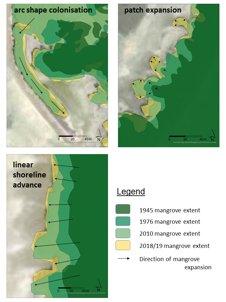
Mangrove shorelines in the study area increased in extent and naturally prograded seawards over the last seven decades, in spite of sea–level rise. The researchers identified three distinct types of mangrove growth. In arc-shaped colonization, mangroves colonized elongated bars or offshore spits formed by alongshore sediment transport. Arc-shaped colonization showed the fastest rates of expansion, but only made up a small percentage of the total mangrove area. With linear shoreline advance, new mangrove zones grow seaward and parallel to the coastline. This was the most frequent colonization pattern and contributed the most to mangrove expansion. The third type, colonization by patch expansion, is characterized by offshore expanding knobs separated by indentations with little or no expansion. This was the second most frequent pattern of colonization Applying mangrove planting patterns that mimic these different natural colonization processes may enhance restoration success. For sites with low wave energy, grid patterns in rows spaced a meter apart are effective; this is the most commonly used pattern and resembles linear shoreline advance. For more exposed or less calm sites, planting in a V pattern could help deflect wave energy; and for even stronger conditions, cluster planting that resembles offshore patch expansion is recommended. There are no equivalent planting patterns for arc-shaped colonization apart from using offshore structures. Source: Crameri, N.J. & J.C. Ellison. 2024. Atoll Mangrove Progradation Patterns: Analysis from Jaluit in the Marshall Islands. Estuaries and Coasts. DOI: 10.1007/s12237-024-01331-0 Image: Arc shaped colonization, patch expansion, and linear shoreline advance / The Authors Lessons From Over 20 Years of SETs in Puget Sound Estuaries can be resilient if sediment delivery is maintained. Estuaries and their associated intertidal wetlands provide valuable ecosystem services as well as important habitat for fish and other wildlife, but they can only persist if sediment accretion equals the rate of sea–level rise. In Washington’s Puget Sound, up to 80% of historic estuarine habitat has been lost to development, and continued losses are expected through the end of the century due to climate change. To determine whether these habitats will keep pace with current and projected sea–level rise, researchers assessed vertical rates of elevation change using a network of surface elevation tables and marker horizons (SET-MH) installed in wetlands throughout five estuaries over the past two decades. Each of these systems—Nisqually, Snohomish, Stillaguamish, and Skagit River estuaries, and Padilla Bay—has distinct hydrologic and topographic characteristics representing a very broad range of conditions. Rates of surface elevation change varied widely among and within these estuaries. Many sites appear to be keeping pace with current rates of relative sea–level rise, and some areas (sediment-rich Stillaquamish and Skagit) are on track to meet or even exceed projected rates through the end of the century—as long as sediment delivery is maintained. In contrast, rates were consistently negative at low-elevation sites in sediment-starved Padilla Bay. Sediment load was the largest driver (explaining 45% of model variation), though elevation relative to mean tidal level, position in the estuary relative to the sediment delivery source, vegetation, habitat connectivity, and restoration status all interact to influence surface elevation change. Monitoring methods such as SETs that track elevation change and sediment accretion through time play a pivotal role in identifying sensitive habitats, especially tidal marshes. With the impending threat of accelerated sea–level rise, it’s becoming increasingly important to gauge resilience to rising tidal levels and identify the factors that reduce their vulnerability. Source: Davis, M.J. et al. 2024. Vulnerability to Sea‑Level Rise Varies Among Estuaries and Habitat Types: Lessons Learned from a Network of Surface Elevation Tables in Puget Sound. Estuaries and Coasts. DOI: 10.1007/s12237-024-01335-w Centuries-Old Shell Middens Help Stabilize Tampa Bay Shorelines Protecting archaeological sites offers cultural as well as ecological benefits.
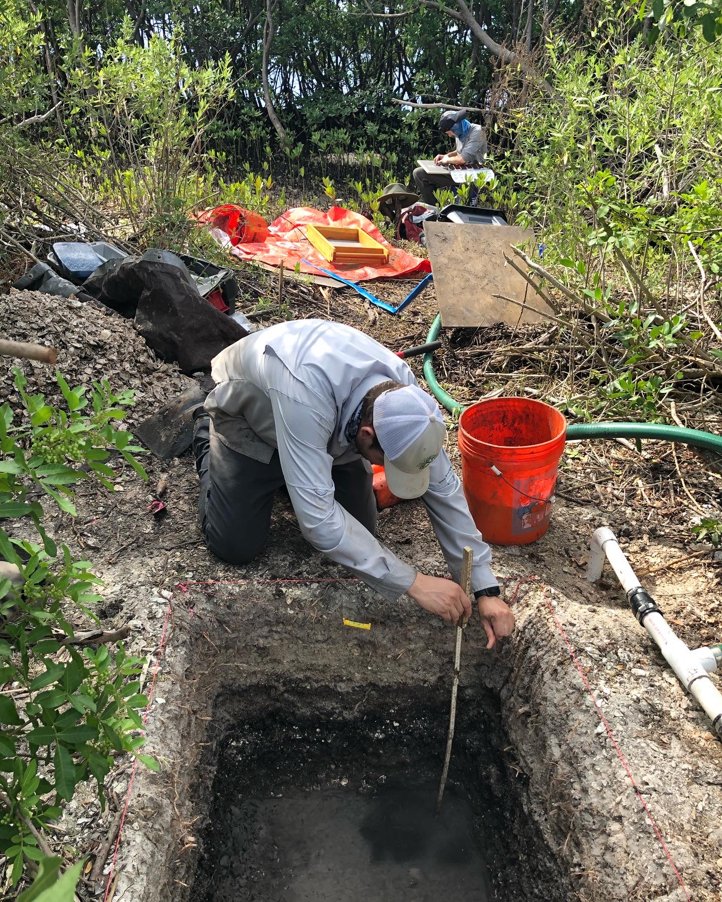
To better understand the transformative interactions between sea–level rise and coastal shell-bearing sites, researchers sorted the contents of 16 cores collected near the apex of middens and mounds at three sites within Tampa Bay Estuary. They found evidence that shell-bearing sites attenuate wave energy similar to other shoreline stabilization structures, suggesting that they are protecting uplands. Additionally, different sites contained different ratios of shells, invertebrate species, and sediment, providing insight into storm impacts. The cores also documented mangroves growing over intact shell middens and preserving the cultural material below. To further examine the scale at which mangroves encroach on archaeological sites, the team conducted geospatial analyses at 623 shell-bearing sites within a kilometer and a half of the shoreline. They found wetland encroachment occurring at 247 of the sites; it’s likely that these sites are facilitating the present-day migration of wetlands to higher ground. An additional 93 archaeological sites in upland habitats could provide topographic relief and durable substrate to buffer storm energy and facilitate the future migration of wetlands as sea levels rise. In turn, migrated wetlands protect the shell-bearing sites within them. Native American shell-bearing sites are durable coastal features that continue to impart benefits on coastal habitats. By understanding these sites as part of dynamic coastal habitats, managers can better integrate them into long-term wetland management strategies. The researchers advocate further collaboration between archaeologists and managers and the inclusion of descendant communities. Source: Rogers, J.A. & K. Jackson. 2024. Transformative Impacts of Sea‑Level Rise, Storm Surge, and Wetland Migration on Intertidal Native Shell‑Bearing Sites in Florida’s Largest Open‑Water Estuary, Tampa Bay, Florida, USA. Estuaries and Coasts. DOI: 10.1007/s12237-024-01329-8 Image: Excavations at Tampa Bay shell-bearing sites, like this 1x1 m unit, revealed sharp contacts between storm redeposited material and intact midden / The Authors |


