- About
- Affiliates
- Join
- Publications
- Estuaries and Coasts
- CERF's Up! Quarterly Bulletin
- Coastal & Estuarine Science News (CESN)
- CERF-Lit
- Advertising
- Programs & Events
- Inclusive Culture
- Communities
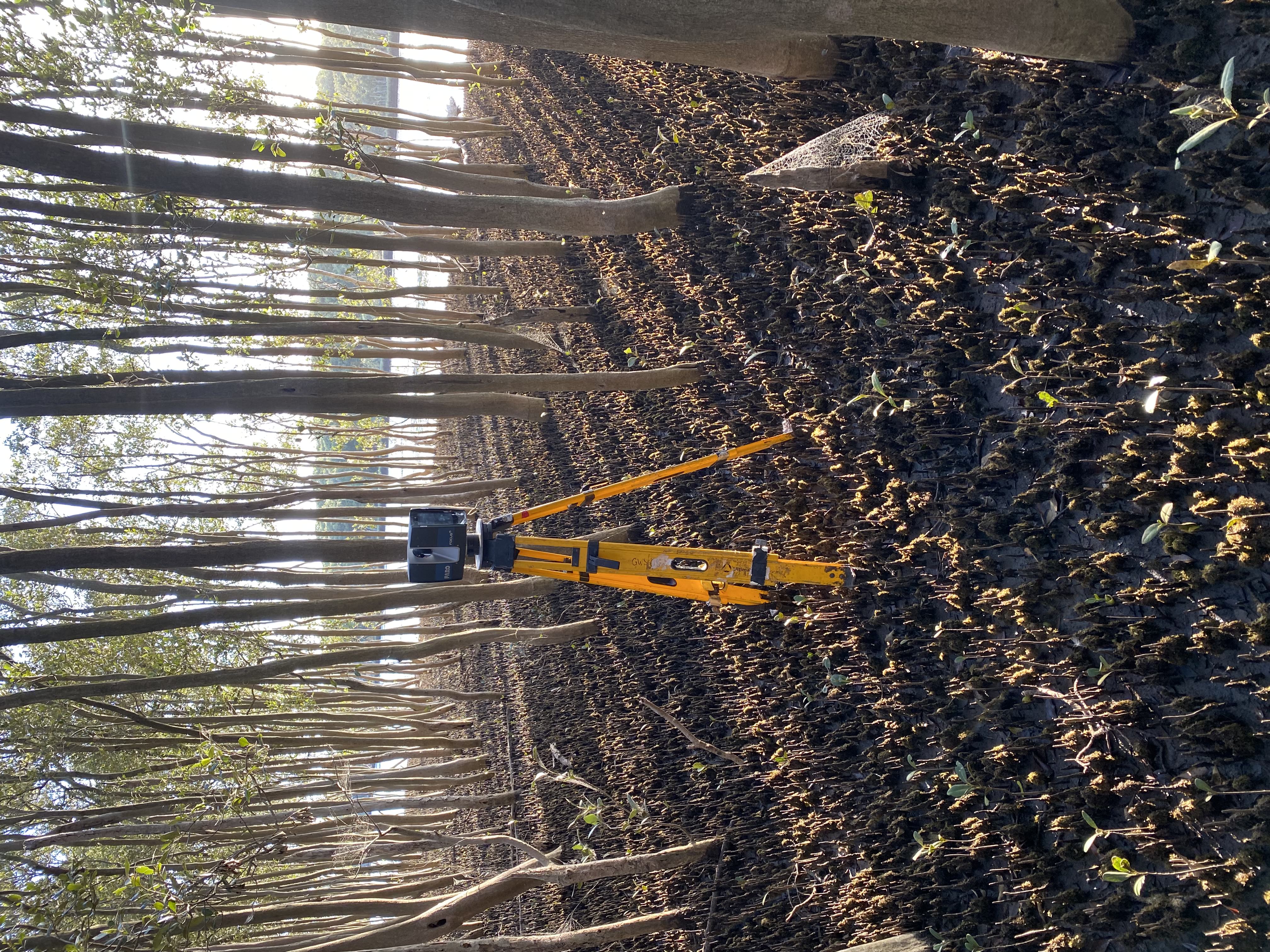
Coastal & Estuarine Science News (CESN)The mission of Coastal & Estuarine Science News (CESN) is to highlight the latest research in the journal Estuaries and Coasts that is relevant to environmental managers. It is a free electronic newsletter delivered to subscribers on a bi-monthly basis. Sign up today! 2025 Issue 5Table of ContentsApplying terrestrial laser scanning to mangrove forests
Researchers in southeastern Australia used TLS to scan grey mangroves (Avicennia marina) in a dozen sites spanning different types of estuaries. They developed an automated software tool for post-processing the images and compared the results with field-collected data that included tree height, stem diameter and density, and the diameter, height, and density of vertical aerial roots called pneumatophores. Initial results using TLS were promising for estimating stem density and diameter. The method performed best in forests where mangroves have similar age, tree heights, stem diameters, and canopy elevations such as those in drowned river valleys; it was less effective in intermittently open and closed estuaries where trees are smaller and foliage is dense. In barrier estuaries, 35 to 45 trees would need to be measured by hand or processed using TLS to calculate characteristics representative of the forest—compared to 10 to 20 trees needed for drowned river valleys. Pneumatophores were more challenging to quantify, particularly in areas where they were covered with mud or marine life. Understory information cannot be readily obtained through satellite remote sensing, and mangrove evaluations for restoration projects have typically been based on one tree or used simplified vertical profiles. The results presented here suggest that TLS can be a valuable tool for getting information on mangroves and potentially other species as well. Source: Dunlop, T. et al. 2025. Quantifying Mangrove Forest Attributes Using Terrestrial Laser Scanning. Estuaries and Coasts. DOI: 10.1007/s12237-025-01533-0 Image: The TLS device in a mangrove forest / Thomas Dunlop Predicting Harmful Algal Blooms Using Machine Learning An early warning system for Heterosigma Harmful algal blooms (HABs) occur in a diversity of coastal environments and are caused by hundreds of toxic or nuisance algal species driven by both anthropogenic and natural factors. Research on harmful algal blooms usually involves mechanistic models, which allow for a deeper understanding of mechanisms but aren’t useful for predictions. Machine learning models—which combine ecological monitoring with statistical models—can be useful for identifying environmental predictors that can be used for forecasting. Researchers developed a machine learning model to predict Heterosigma akashiwo blooms in the eutrophic Hudson-Raritan Estuary between New York and New Jersey. For their Random Forest (RF) machine learning model, the team utilized a 12-year dataset of water quality variables and plankton communities sampled monthly from six sites in the estuary. This long-term data made it possible to test and train a robust model. The RF model predicted blooms accurately approximately 88% of the time, with a 7% error for low-density months and 36% error for high-density months. River discharge, precipitation, and the abundances of the dinoflagellate phytoplankton Heterocapsa rotundata and the flagellate phytoplankton Chlamydomonas spp. were the best predictors of H. akashiwo abundance in the estuary. By utilizing system-specific, real-world data, this machine learning method gives managers the opportunity to predict, prepare for, and possibly manage HABs—reducing the extent of adverse environmental, economic, and human health effects. The model can now be used to help guide continued monitoring, such as which attributes to measure and the frequency of the measurements. It can also be paired with time-series analysis to allow adaptive management and test the effectiveness of management actions. Source: Flint, E. et al. 2025. Machine Learning and Adaptive Monitoring for Harmful Algal Bloom Management. Estuaries and Coasts. DOI: 10.1007/s12237-025-01585-2 Least Terns and Snowy Plovers Seek Wide Berms How beachface morphology impacts beach-nesting birds
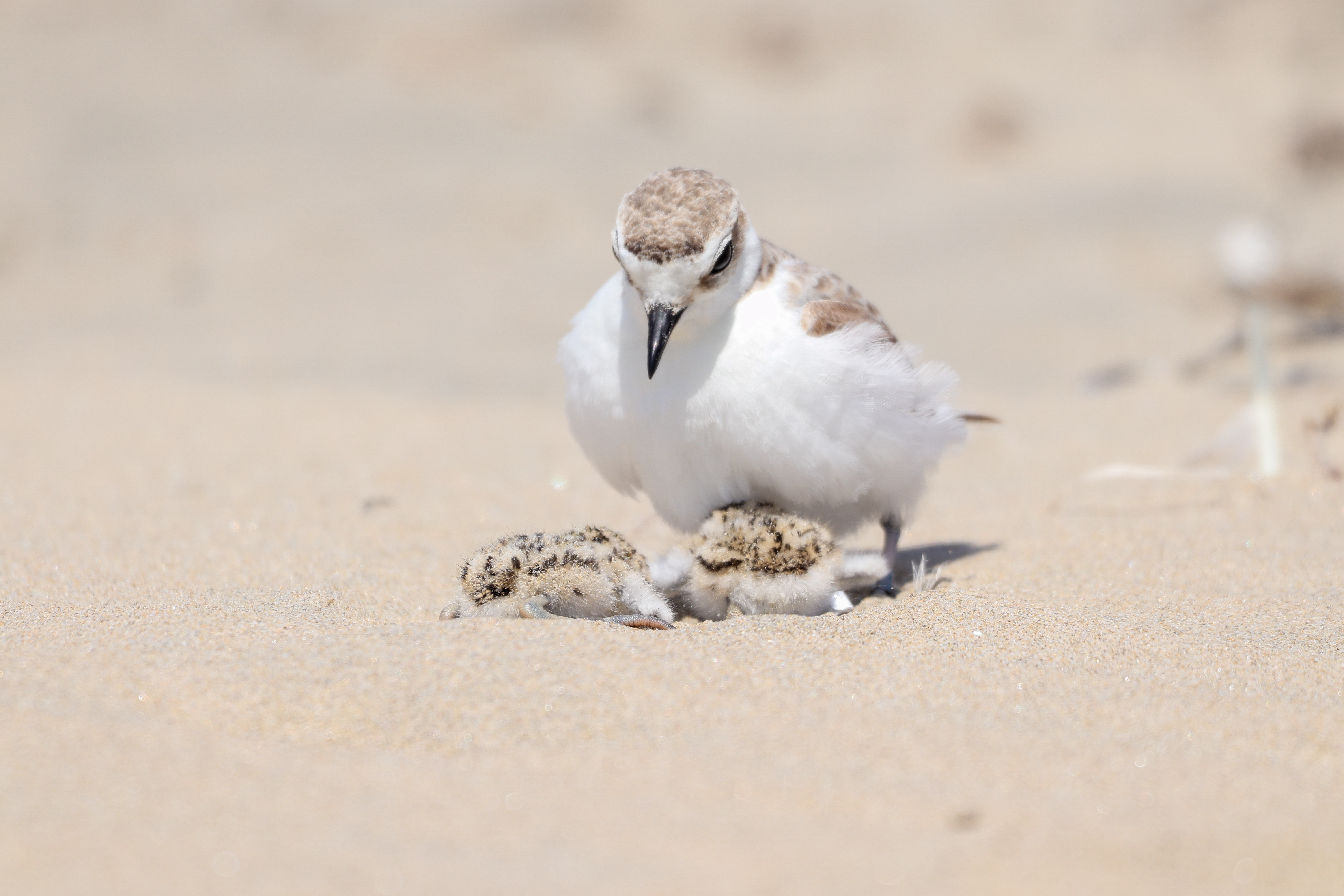
At Barra del Estero de Punta Banda Beach in Baja California, Mexico, researchers investigated the effects of beachface morphology on nest site selection and hatching success of two beach-nesting species of conservation concern: least terns (Sterna antillarum) and snowy plovers (Anarhynchus nivosus). They compiled wave data and four decades of satellite imagery, manually conducted topographic surveys, and monitored 411 tern nests and 84 plover nests. Beachface morphology was highly variable, seasonally to interannually, and had a strong influence on the placement and fate of both tern and plover nests during the breeding season. In particular, nest abundance was highest in areas with a berm—a gently sloping sand platform, ideally several tens of meters wide and located roughly half a meter above the highest spring high-tide level. For both species, nests located on berms had a significantly higher survival rate (76%) compared to nests in areas without berms (24%). Nest placement was more closely related to summertime berm presence than long-term beach stability: Areas with highly stable, but steep, bermless beachfaces had significantly lower nest abundances compared to areas that were highly dynamic but exhibited prominent summertime berms. Even though berms naturally erode during winter storms, they provide secure nesting platforms in the summer that dissipate wave energy and protect from tidal flooding. That means the ability of the beach to recover and rebuild wide berms after periods of high wave energy is critical to the success of beach-nesting birds. Beachface morphology should be taken into account when conserving or restoring habitats to enhance breeding conditions for vulnerable wildlife on sandy beaches. Managers may want to focus efforts on areas with flat, elevated platforms (or replicate these features with beach renourishment practices), especially in the face of increasing sea-level rise and storm impacts. Source: Ruiz de Alegría‑Arzaburu, A. et al. 2025. The Impact of Beachface Morphology on Habitat Suitability and Breeding Success of Least Terns and Snowy Plovers. Estuaries and Coasts. DOI: 10.1007/s12237-025-01574-5 Image: Snowy plovers / Jonathan Vargas Caution! Transplanted Native Spartina Can Run Amok Spartina can convert restored tidal creeks and mudflats into salt marshes
Researchers investigated native Spartina encroachment into areas originally planned as tidal creek or mudflat habitat at the restored San Dieguito Wetlands. Detailed measurements were taken before, during, and after wetland reconstruction using aerial imagery and elevation and vegetation surveys. The restoration project was partially successful but there were some surprising results. Transplanted Spartina grew beyond its planned elevation range and into lower elevation areas, converting 42% of built tidal creek and mudflat habitat to salt marsh. This rapid and dense coverage likely occurred due to a variety of factors, including clonal growth, high local seed supply, and the ability of Spartina to trap sediments, elevating the area and creating suitable salt marsh habitat through positive feedback. The built tidal creeks likely were also insufficiently excavated—which made them unable to maintain their geomorphology as tidal creeks. These findings emphasize the importance of considering wetland hydrology and project design elevations relative to site-specific elevation ranges of desired wetland species. Although salt marshes provide valuable ecosystem services such as nesting habitat for the endangered Ridgway’s Rail, salt marsh encroachment can interfere with shorebirds that feed in mudflats and fish and invertebrates that rely on tidal creeks for passage. Given the trade-offs between habitat types, managing encroachment requires a better understanding of site-specific elevation ranges and wetland hydrology. At this study site, tidal creeks could be deepened to match conditions that do not support salt marsh growth. Source: Smith, R.S. et al. 2025. Habitat Conversion by Native Spartina Highlights the Importance of Wetland Restoration Design Relative to Site‑Specific Vertical Range of Vegetation. Estuaries and Coasts. DOI: 10.1007/s12237-025-01576-3 Image: Tidal creek at the San Dieguito Wetlands / Kathryn Beheshti |